Geodata Analysis and Technical Consulting
Complex geodata transformed into useful knowledge
Accurate information at the service of your projects
We offer detailed characterisation of the area of interest to optimise each phase of your project
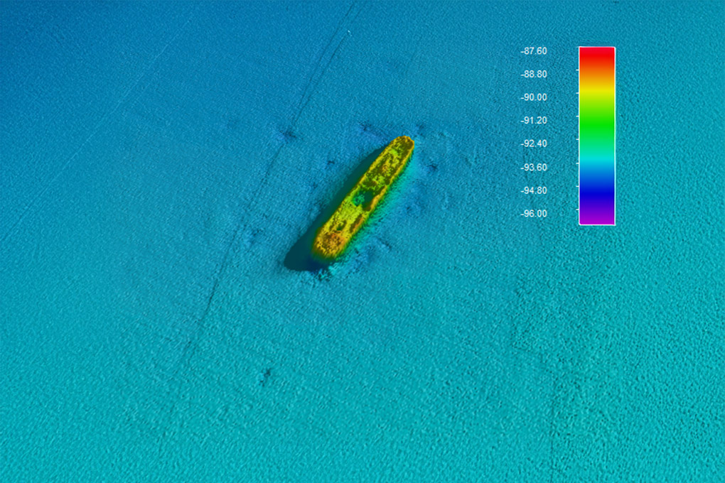
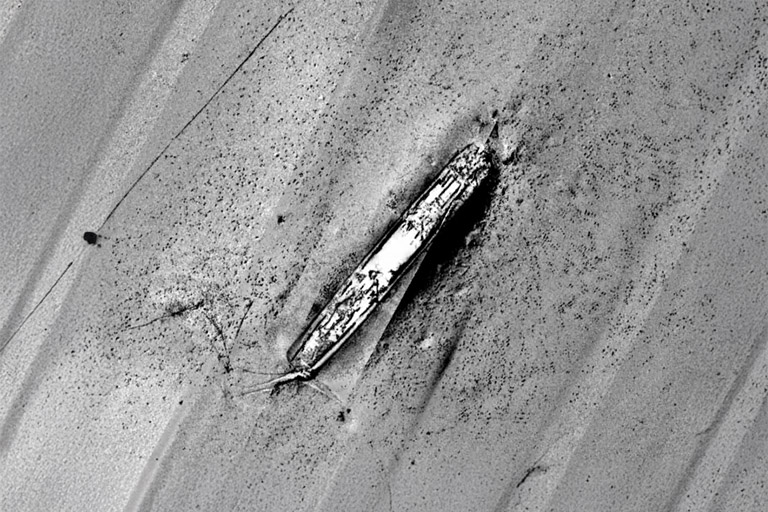
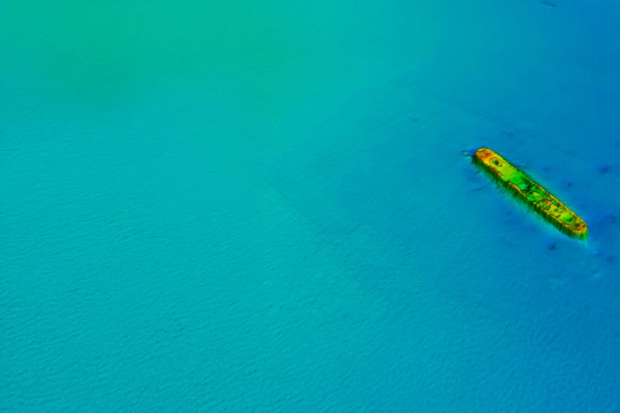
Geophysical Data Interpretation
Marine data converted into strategic value
At our data centre, we process and interpret acoustic, high-resolution seismic and marine magnetometry data, identifying morphologies, geological structures and risks. Our reports combine technical accuracy with clear visualisations to facilitate infrastructure design and decision-making.
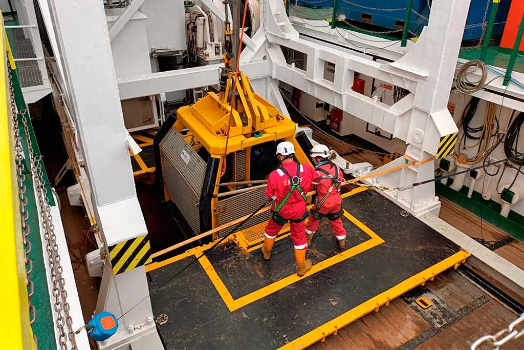
Geotechnical Data Interpretation
Geotechnical information analysed for safe design
We conduct on-board and laboratory tests to determine essential geotechnical parameters. We integrate this information with the geophysical context, providing practical recommendations for the design of foundations, dredging, cabling and offshore structures in various marine environments.
Integrated Model of the Seabed and Subsoil
Comprehensive view for a better understanding of the environment
We integrate geophysical, geotechnical and historical data into three-dimensional models of the seabed and subsoil. This approach improves understanding of the geological environment and reduces uncertainty in critical engineering and planning phases, facilitating more informed and reliable decision-making.
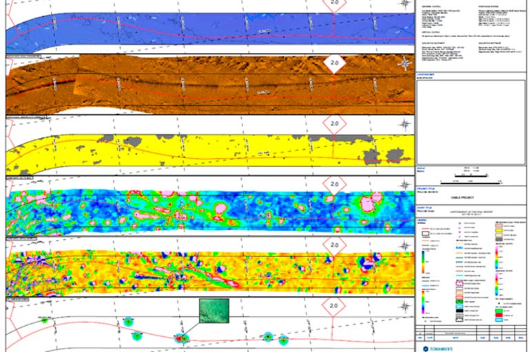
GIS Mapping and Technical Reports
Spatial visualisation of field data
We develop technical reports and geospatial models, combining bathymetric, geophysical, geotechnical and environmental data. We apply advanced GIS tools to provide clear and customisable visualisation that enables effective technical planning and the design of accurate solutions.
Specialised Consulting
Over 40 years advising on complex marine projects
We provide expert support in all phases of your project: from the analysis of existing information, campaign design and data acquisition and processing to final analysis, validation and data interpretation. We help optimise resources and facilitate decision-making based on scientific data.
Contact our Data Center
We answer your questions about processing and interpreting marine data